about
Hi! I'm a junior at UC Berkeley studying Electrical Engineering and Computer Science. I'm interested in the intersection of human-computer interaction, computer graphics, and future hardware. Currently, I'm taking classes in interface design, operating systems, and computer graphics. I also enjoy reading, playing tennis, and learning new languages. This website serves as a way to log my work and keep track of what I've built or in progress.
portfolio
MAY 2024
graphics
CS 184 graphics assignments
APR 2024
iOS
AR navigation and event app
MAR 2024
design
web
redesign of the UC Berkeley SWE website
FEB 2024
design
web
markdown to textbook parser
JAN 2024
writing
berkeley class reviews
DEC 2023
graphics
3D animated short
DEC 2023
hardware
GPS-navigated drone
🧭 Berkeley ARscape
SwiftUI
MapKit
ARKit
RealityKit
Github ↗Goal
My goal was to create an app that could help people find events on campus when they were already there. A quick look up with the camera could help you see events going on that day and even show you routes. I aimed to use AR to highlight a path to follow and then a marker displayed outside the building to highlight what event was going on. In the long term, I also wanted to add a feature to track attendance using the AR marker as well.
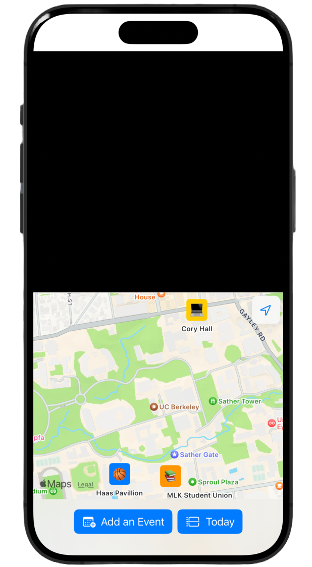
MapKit
The first step was designing the map and allowing users to add event. I created buttons for these actions, and limited the search area for the location of an event to Berkeley in order to make sure that I didn’t show too many results.
Spline
I designed these AR markers in Spline, to add a unique touch to advertising of events. I added some more common Berkeley events as designs. The goal is for these AR markers to be displayed next to the location of the event, allowing for users to quickly see what's going on nearby.
ARKit and Geo Anchors
First, I had to check if geographical anchors were supported for Berkeley, as there are a handful of cities across the world where they are supported. Luckily, there are many cities and counties in California which have been mapped by LiDAR and I was able to pass the first check.
I then added these markers as location anchors to the specific places where an event was happening. However, because Spline didn't convert to USDZ format for free, I used existing USDZ files in Reality Composer Pro.
Results
These were the final screens from the app, which include placing an event and using it during the daylight to see the AR anchor displayed at the location.
This app was mostly a SwiftUI prototype, with no server or database pulling in any list of events and no unique users. Instead, it was a test to see if this was something feasible/interesting to pursue and build an app for my own personal use case for fun!